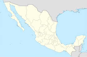
Pabellón de Arteaga Municipality
Appearance
Pabellón de Arteaga | |
|---|---|
 Municipality location in Aguascalientes | |
| Coordinates: 22°09′N 102°16′W / 22.150°N 102.267°W | |
| Kintra | |
| State | Aguascalientes |
| Municipal seat | Pabellón de Arteaga |
| Area | |
| • Total | 199.33 km2 (76.96 sq mi) |
| Population (2010) | |
| • Total | 41,862 |
Pabellón de Arteaga is municipality in the Mexican state o Aguascalientes. It staunds at 22°09′N 102°16′W / 22.150°N 102.267°W in the central pairt o the state. The ceety o Pabellón de Arteaga (2005 population: 26,797) serves as its municipal seat. The municipality haed a population o 38,912 an an aurie o 199.33 km² (76.97 sq mi). Its lairgest ither toun is namit Emiliano Zapata.
Settlements
[eedit | eedit soorce]The municipality haes a total o 117 settlements. The main anes are:
| Settlement | Population |
|---|---|
| Pabellón de Arteaga | 26,797 |
| Emiliano Zapata | 2,851 |
| Las Ánimas | 1,842 |
| Fraccionamiento Santa Isabel | 1,027 |
| Santiago | 953 |
| San Luis de Letras | 850 |
| Total | 38,912 |
References
[eedit | eedit soorce]- Link to tables of population data from Census of 2005 Instituto Nacional de Estadística, Geografía e Informática (INEGI)
- Aguascalientes Archived 2007-05-15 at the Wayback Machine Enciclopedia de los Municipios de México
Freemit airtins
[eedit | eedit soorce]- Ayuntamiento de Pabellón de Arteaga Archived 2022-01-24 at the Wayback Machine Offeecial wabsteid
- Aguascalientes state govrenment (in Spaingie)


